Category:Langley, Essex
Jump to navigation
Jump to search
English: Langley is a village and civil parish in the English county of Essex, seven miles west-south-west of Saffron Walden.
village and civil parish in the English county of Essex  | |||||
| Upload media | |||||
| Instance of | |||||
|---|---|---|---|---|---|
| Location | Uttlesford, Essex, East of England, England | ||||
 | |||||
Subcategories
This category has the following 2 subcategories, out of 2 total.
B
- The Bull, Langley (1 F)
Media in category "Langley, Essex"
The following 81 files are in this category, out of 81 total.
-
 Baptist Chapel, Langley Upper Green - geograph.org.uk - 4233562.jpg 640 × 480; 157 KB
-

-
 Brices Yard, Butts Green - geograph.org.uk - 4069093.jpg 1,600 × 1,200; 654 KB
-
 Buildings, Gipsy Corner Farm - geograph.org.uk - 4738437.jpg 640 × 480; 90 KB
-
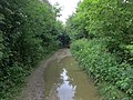 Byway from Butts Green - geograph.org.uk - 4069105.jpg 1,600 × 1,200; 983 KB
-
 Church Cottage - geograph.org.uk - 5927404.jpg 1,200 × 900; 497 KB
-
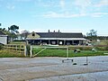
 Cricket club at Langley - geograph.org.uk - 6055216.jpg 4,608 × 3,456; 4.62 MB
-
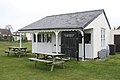 Cricket Pavilion - geograph.org.uk - 771619.jpg 640 × 426; 134 KB
-
 Duddenhoe Grange - geograph.org.uk - 4069002.jpg 1,600 × 1,200; 591 KB
-
 Edge of Oldfield Grove - geograph.org.uk - 2485034.jpg 1,024 × 768; 349 KB
-
 Entering Langley Upper Green - geograph.org.uk - 5471918.jpg 1,024 × 768; 300 KB
-
 Essex high point - geograph.org.uk - 4054747.jpg 1,600 × 1,064; 407 KB
-
-
 Footpath Across Barley Field - geograph.org.uk - 5471932.jpg 1,024 × 768; 243 KB
-
 Footpath Looking South - geograph.org.uk - 5471959.jpg 1,024 × 768; 259 KB
-
 Footpath Near To Oldfield Grove - geograph.org.uk - 5471940.jpg 1,024 × 768; 261 KB
-
 Footpath Sign And Gates - geograph.org.uk - 5577539.jpg 1,024 × 768; 305 KB
-
 Footpath to Meesden. - geograph.org.uk - 700221.jpg 640 × 480; 72 KB
-
 Footpath, to the north of Langley - geograph.org.uk - 2485015.jpg 1,024 × 768; 263 KB
-
 Houses in Upper Green - geograph.org.uk - 4068988.jpg 1,600 × 1,200; 617 KB
-
 Lane towards Langley - geograph.org.uk - 4233517.jpg 640 × 480; 129 KB
-
 Langley - geograph.org.uk - 4054728.jpg 1,600 × 1,064; 341 KB
-
 Langley Lower Green Ford - geograph.org.uk - 3373365.jpg 3,872 × 2,592; 2.28 MB
-
 Looking Along The County Boundary - geograph.org.uk - 5577528.jpg 1,024 × 769; 234 KB
-
 Lower Green, Methodist Chapel - geograph.org.uk - 282011.jpg 640 × 480; 109 KB
-
 Meeting of paths, Oldfield Grove, Langley, Essex - geograph.org.uk - 4277236.jpg 1,024 × 768; 222 KB
-
 Minor road to Butts Green - geograph.org.uk - 4068953.jpg 1,600 × 1,200; 642 KB
-
 Minor road to Butts Green - geograph.org.uk - 4068973.jpg 1,600 × 1,200; 846 KB
-
 Muddy Track - geograph.org.uk - 5633531.jpg 768 × 1,024; 312 KB
-
 New houses at Langley - geograph.org.uk - 4068993.jpg 1,600 × 1,200; 535 KB
-
 Oilseed rape field - geograph.org.uk - 4068963.jpg 1,600 × 1,200; 773 KB
-
 Oldfield Grove - geograph.org.uk - 2485028.jpg 1,024 × 768; 287 KB
-
 Ordnance Survey Cut Mark - geograph.org.uk - 4210544.jpg 480 × 640; 131 KB
-

-
 Park Lane enters Lower Green, Langley - geograph.org.uk - 4233528.jpg 640 × 480; 160 KB
-
 Path towards Oldfield Grove - geograph.org.uk - 2485024.jpg 1,024 × 768; 258 KB
-
 Pheasant feeding station by Up End track - geograph.org.uk - 707303.jpg 640 × 426; 241 KB
-
 River Stort - geograph.org.uk - 277962.jpg 640 × 480; 96 KB
-
 River Stort north of Lower Green - geograph.org.uk - 282004.jpg 640 × 480; 124 KB
-
 Roadworks - geograph.org.uk - 5577551.jpg 1,024 × 768; 178 KB
-
 Roper's Lane - geograph.org.uk - 700220.jpg 640 × 480; 90 KB
-
 Skirting a snowy field north of Langley - geograph.org.uk - 6055223.jpg 4,608 × 3,456; 5.57 MB
-
 St John the Evangelist Langley Upper Green - geograph.org.uk - 5471922.jpg 1,024 × 768; 228 KB
-
 St John the Evangelist Langley Upper Green - geograph.org.uk - 5471926.jpg 768 × 1,024; 162 KB
-
 St John the Evangelist, Langley Upper Green - geograph.org.uk - 5123825.jpg 5,472 × 3,648; 3.12 MB
-
 Stile, Harcamlow Way - geograph.org.uk - 3424877.jpg 533 × 800; 143 KB
-

-

-

-
 The Bull, Langley Lower Green, 2018 - geograph.org.uk - 5927411.jpg 1,200 × 900; 303 KB
-
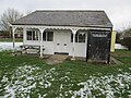
 The Friday Shoppe - geograph.org.uk - 5927423.jpg 1,200 × 900; 281 KB
-
 The Harcamlow Way - geograph.org.uk - 771628.jpg 640 × 426; 160 KB
-
 Track between field and wood - geograph.org.uk - 771610.jpg 640 × 426; 186 KB
-
 Track between field and wood - geograph.org.uk - 771613.jpg 640 × 426; 163 KB
-
 Upper Green, Langley - geograph.org.uk - 3424914.jpg 800 × 533; 139 KB
-
 View from the highest point in Essex - geograph.org.uk - 4054807.jpg 1,600 × 1,064; 391 KB
-
 View south of the Harcamlow Way - geograph.org.uk - 4054722.jpg 1,600 × 1,064; 347 KB
-
 Village house, Langley - geograph.org.uk - 2484950.jpg 1,024 × 768; 174 KB
-
 Wheat field - geograph.org.uk - 4068947.jpg 1,600 × 1,200; 677 KB
-
 Wheat field - geograph.org.uk - 4068968.jpg 1,600 × 1,200; 759 KB
-
 Wheat field, near Langley - geograph.org.uk - 2485022.jpg 1,024 × 768; 315 KB
-
 Wood Anemones, Oldfield Grove - geograph.org.uk - 3424951.jpg 800 × 533; 212 KB
-
 Bluebells in High Wood - geograph.org.uk - 404839.jpg 640 × 480; 139 KB
-
 Cakebread's Lane - geograph.org.uk - 721108.jpg 640 × 425; 81 KB
-

-

-

-

-
 Farmhouse at Further Ford End, Essex - geograph.org.uk - 268368.jpg 640 × 466; 77 KB
-
 Farmhouse at Yew Tree Farm - geograph.org.uk - 268362.jpg 640 × 433; 84 KB
-
 Farmland at Gypsy Corner Farm - geograph.org.uk - 444422.jpg 640 × 480; 70 KB
-
 Ford near Cooper's End - geograph.org.uk - 58593.jpg 480 × 360; 25 KB
-
 Ford, Langley Lower Green - geograph.org.uk - 58589.jpg 480 × 360; 24 KB
-
 House and Brook at Coopers End - geograph.org.uk - 771631.jpg 640 × 426; 231 KB
-
 House at Coopers End - geograph.org.uk - 771632.jpg 640 × 426; 186 KB
-
 Langley Lawn Farm - geograph.org.uk - 707310.jpg 640 × 426; 129 KB
-
 River Stort in Lower Green, Langley - geograph.org.uk - 281998.jpg 640 × 480; 104 KB
-

-
 The road at Ford End - geograph.org.uk - 267958.jpg 640 × 480; 106 KB
-
 Track leading to Langley Lawn Farm - geograph.org.uk - 707318.jpg 640 × 426; 121 KB
-
 Up End - geograph.org.uk - 700151.jpg 640 × 480; 116 KB


